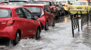
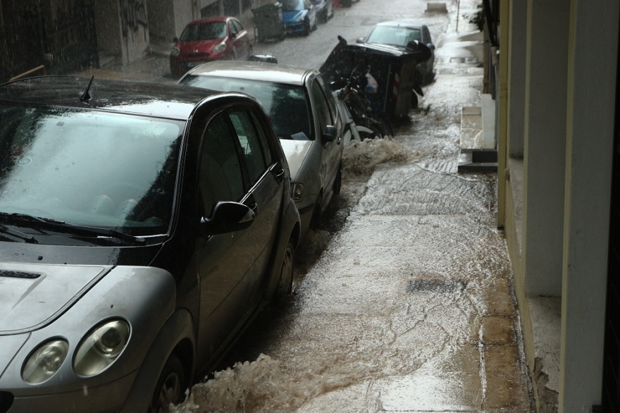
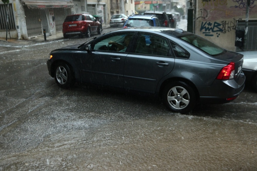
Heavy rain and lightning have been affecting Attica in recent hours, causing major central roads to “flood.” Traffic congestion is making it difficult for drivers to move around.
Specifically, roads in the Southern Suburbs, from Kavouri to Alimos, are heavily congested, with many traffic lights malfunctioning, exacerbating the traffic issues.
In central Athens, roads from Syntagma to Omonia are facing significant problems, but the worst situation is on Kifisos Avenue, which is jammed from Agioi Anargyroi to Piraeus.
See live traffic updates here.
Κυκλοφοριακό κομφούζιο λόγω της κακοκαιρίας, στη Λεωφόρο Κηφισίας #κακοκαιρία pic.twitter.com/3M0yv0g3XE
— flash.gr (@Flashgr_) August 30, 2024
In the northern suburbs, Kifissia Avenue has increased traffic, especially at the height of the Chlandrios to Maroussi, in the direction of Kifissia.
Problems on Attiki Odos
Meanwhile, on Attiki Odos, drivers are experiencing delays of 15-20 minutes from the Plakentias junction to the Metamorfosi junction.
There are also delays on the Elefsina-bound side from the Kifisias junction to the Metamorfosi junction, ranging from 15 to 20 minutes.
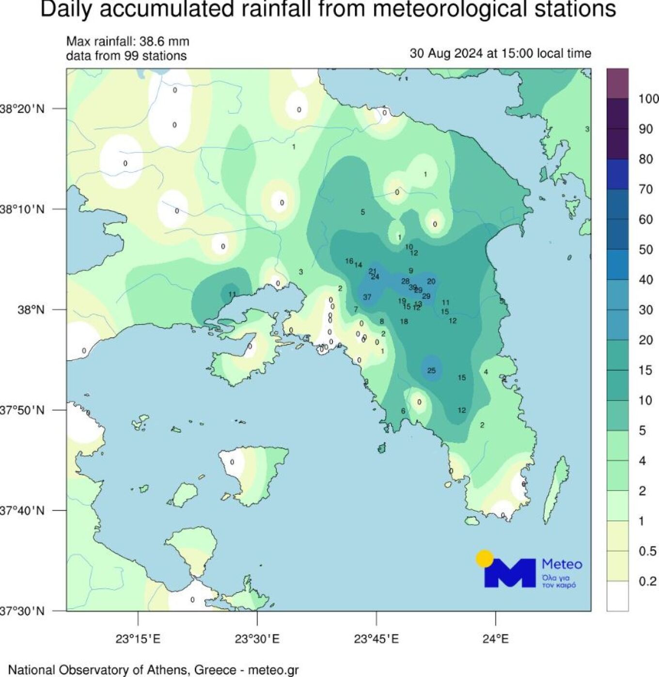
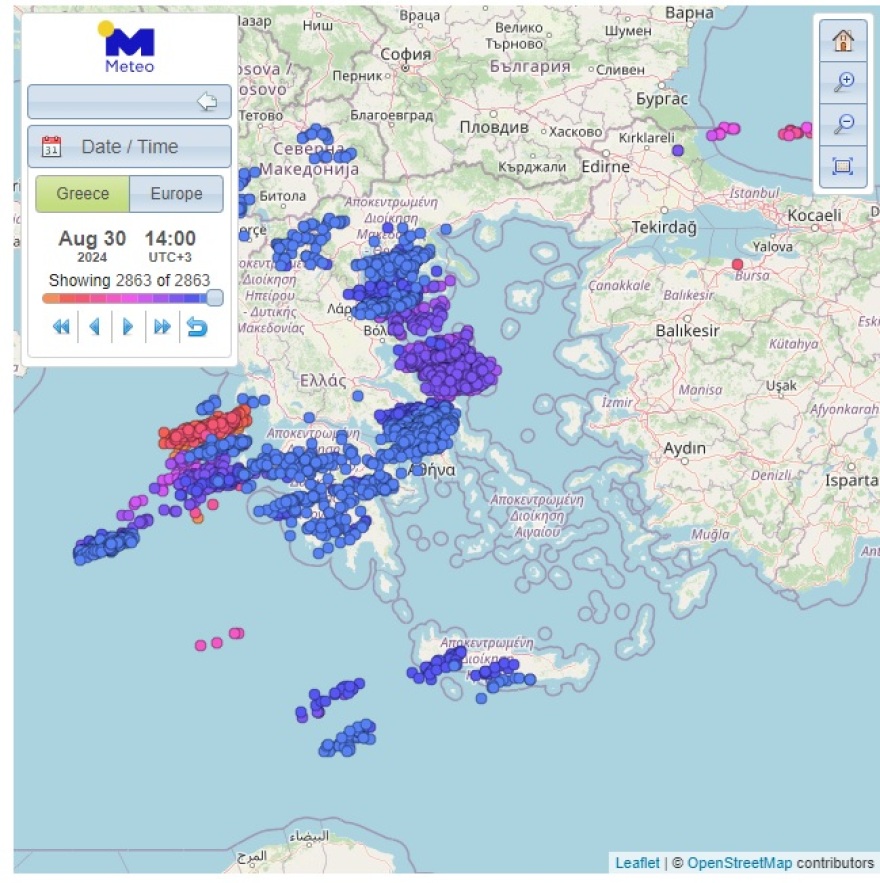
Significant rainfall has been recorded in Athens by midday. The following map shows the total rainfall up to 15:00 in Attica, as measured by 70 stations of the meteo.gr network of the National Observatory of Athens.
According to Kostas Lagouvardos, Director of Research at the National Observatory of Athens, the highest rainfall levels were recorded in the center and northern parts of the basin, with 39 mm in Vrilissia, 37 mm in Patissia, 29 mm in Maroussi, and 24 mm in Metamorfosi.
Update on Severe Weather Alert
The severe weather alert issued on Thursday has been updated today based on the latest forecast data.
Specifically, cold and unstable air masses in the upper atmosphere will remain over our country until Saturday (31-08-24), affecting most of the mainland with heavy rain and thunderstorms, accompanied by frequent lightning and local hailstorms. These phenomena will temporarily be accompanied by very strong winds (squalls).
Specifically:
Heavy rain and thunderstorms are expected:
A. Today, Friday (30-08-24)
- In the afternoon hours in Central Macedonia (mainly in Halkidiki), Eastern Macedonia, Peloponnese, Central Greece (mainly central and eastern, including Attica), and temporarily in Evia, Sporades, Epirus, and Thessaly.
B. Tomorrow, Saturday (31-08-24)
- From the morning hours and periodically in Sporades, Evia, and possibly in Thessaly.
- In the afternoon hours in Peloponnese, Central Greece (including Attica), and locally in Epirus and Macedonia (mainly central and eastern).
Weather in Athens
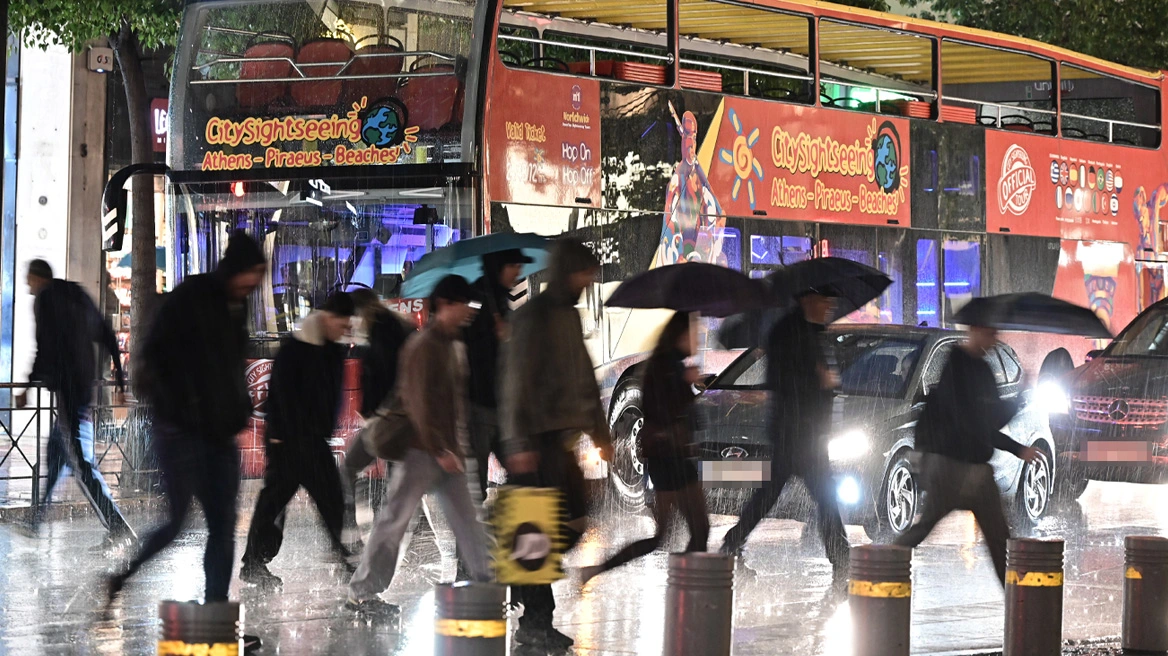
Simultaneously, loud thunder can be heard across the city, and lightning has been visible in the sky since early afternoon.
The bad weather began shortly after 1:00 PM in the northern parts of Attica, spreading to the northern suburbs, and moving south and west, as shown in the following video from Kifisos near Nea Filadelfia. In Patissia, hail has also been reported.
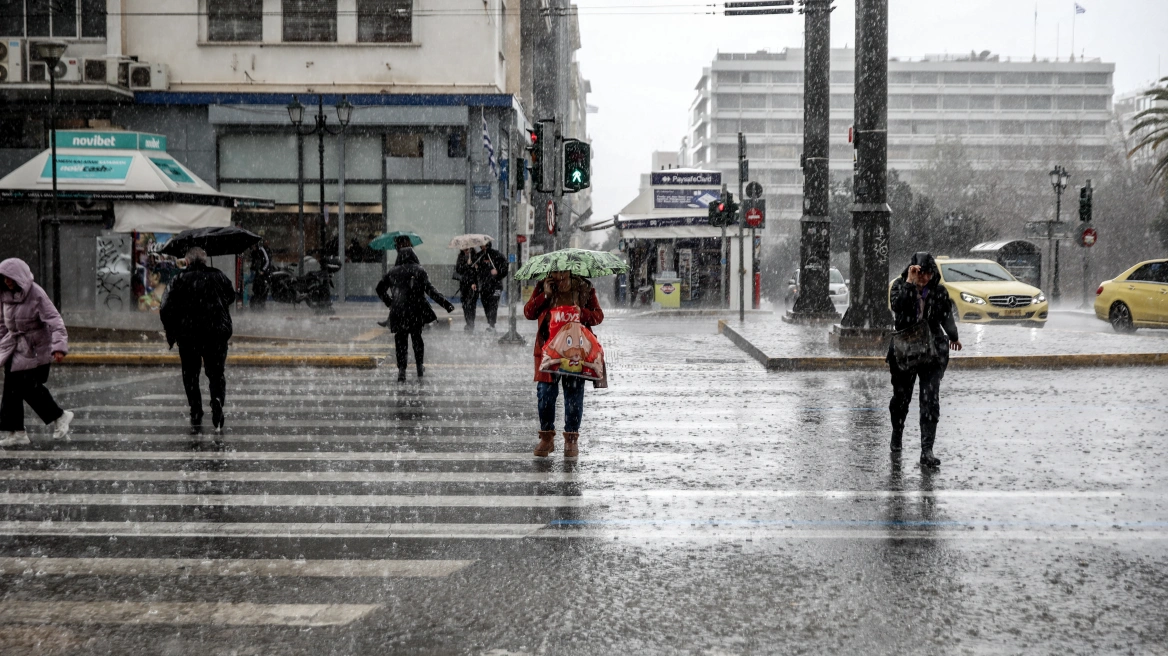
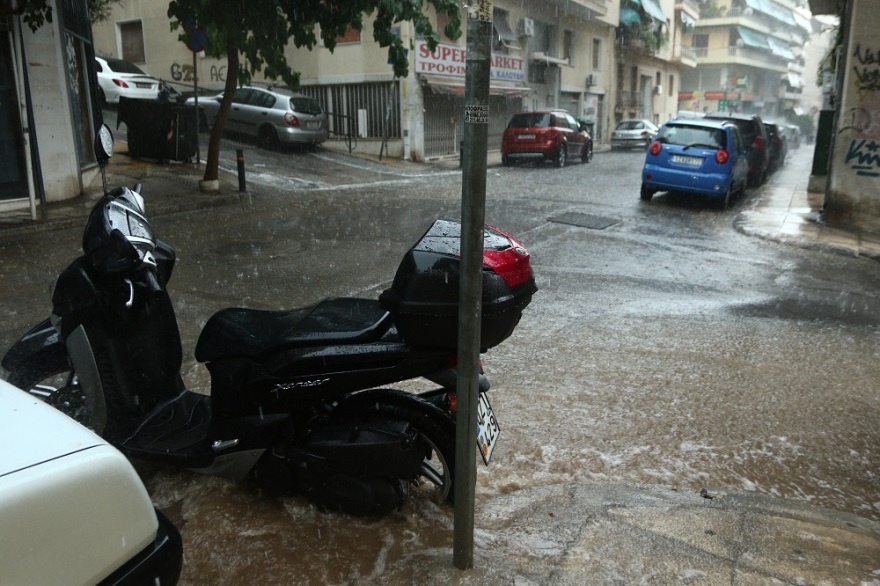
Around 2:30 PM, the rain reached the center of Athens, with citizens and tourists trying to protect themselves from the water with umbrellas and seeking shelter under canopies.
Additionally, in many areas in the Northern Suburbs, particularly in Penteli, there have been power outages due to lightning.
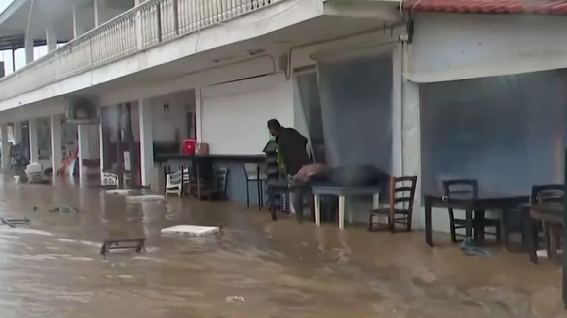
In the area that lost a significant amount of forest due to the fire on August 11th, the weather conditions are severe, and the amount of water is difficult to contain
Around 2:30, the rainfall reached the center of Athens, with citizens and tourists trying to shelter from the water with umbrellas and finding shelter in sheds.
In Evia, severe weather conditions have been experienced in the town of Aliveri since early afternoon. Roads were turned into a river by the intense storm that “hit” areas of central and southern Evia, which is at the center of the bad weather.
According to predictive data, rains and thunderstorms will hit the mainland, Ionian, Northern Aegean and Crete. The phenomena in the mountainous continental areas may be intense in places and accompanied by hail.
To this end, caution is recommended on coasts and beaches due to the possibility of “burrines”, especially in the Ionian Sea and Northern Aegean.
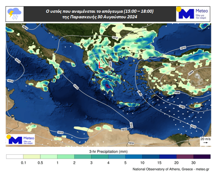
The following maps of meteo / National Observatory show the precipitation expected in the afternoon and early evening hours of Friday.
Temperatures will reach 30-33°C on the mainland and 29-32°C on the islands while winds will not exceed 4-5 Beaufort offshore. It should be noted here that during the stormy periods the winds will probably be accompanied by strong gusts.
Ask me anything
Explore related questions